Wickiup Reservoir fishing access
Oh, the allure of Wickiup Reservoir! It's a place that whispers promises of massive brown trout and feisty kokanee, drawing anglers from all corners of Oregon and beyond. But let's be real, turning that dream into a successful fishing trip often hits a snag long before you even cast a line: figuring out the best way to actually get to the water. Navigating those remote access points, understanding how fluctuating water levels play havoc with boat launches, and just knowing where to start can be incredibly frustrating. This guide is your no-nonsense, realistic companion to unlocking all the fishing access secrets of Wickiup Reservoir, ensuring your focus stays on the fish, not the logistics.
Understanding Wickiup Reservoir's Unique Landscape and Access Challenges
Wickiup Reservoir isn't your average, easily accessible urban lake. Tucked away in the heart of Central Oregon's high desert, it presents a distinctive set of challenges and rewards for anglers seeking its legendary waters. This isn't just about driving to a boat ramp; it's about understanding the terrain, the seasonal shifts, and the dynamic nature of a working reservoir. Neglecting these factors can quickly turn an exciting fishing trip into a frustrating ordeal, leaving you scratching your head instead of reeling in a trophy.
Navigating the Central Oregon High Desert Terrain
The journey to Wickiup Reservoir often means leaving the smooth pavement behind and venturing onto roads that are, shall we say, a little more "rustic." You're heading into high desert country, which comes with its own set of rules and realities. The roads leading to many of the access points, especially those less trafficked, are typically gravel, dirt, or a mix of both. This isn't just a minor inconvenience; it's a significant consideration for your vehicle and your comfort.
During the dry summer months, these roads can become incredibly dusty, coating your vehicle and everything in it with a fine layer of grit. If you're following another car, visibility can drop to zero in a cloud of dust, making careful driving essential. In the spring and fall, especially after significant rainfall or snowmelt, these same roads can transform into muddy, rutted tracks that demand a capable vehicle. Trying to navigate deep mud with a two-wheel-drive sedan, particularly if you're towing a boat, is a recipe for getting stuck, and trust me, cell service is not a guarantee out here. Many experienced anglers highly recommend a vehicle with good ground clearance, and often, four-wheel drive is more of a necessity than a luxury, particularly if you plan to explore beyond the main paved or well-maintained gravel sections. Planning for potential tire issues, like bringing a full-sized spare and tools, isn't being overly cautious; it's being prepared for the reality of the remote Central Oregon backcountry.
The Role of Water Levels in Accessing Wickiup
Perhaps the single biggest frustration and challenge for anglers at Wickiup Reservoir is the wildly fluctuating water levels. Unlike natural lakes, Wickiup is a storage reservoir, meaning its water levels are actively managed for irrigation and other downstream needs. This management results in dramatic seasonal changes that can completely alter access points and fishing conditions. What might be a perfectly usable boat ramp in June could be a mile of exposed mudflats in September.
Imagine planning your big fishing trip, loading up the boat, and driving for hours, only to arrive and find the boat ramp you intended to use is high and dry, or worse, ends in a steep, muddy drop-off. This isn't an uncommon scenario at Wickiup. The reservoir can drop considerably throughout the summer and fall, sometimes exposing vast stretches of shoreline that were submerged only weeks prior. This phenomenon makes solid planning and up-to-date information absolutely critical. If you're relying on specific boat launches, checking current water levels before you leave home isn't optional; it's a must. Websites from organizations like the Bureau of Reclamation often provide real-time data, and a quick call to a local tackle shop can also offer invaluable insights.
These shifting water levels don't just affect boat ramps; they impact shoreline fishing opportunities as well. What might have been a prime, easily accessible bank fishing spot earlier in the season could transform into an expansive, soft, muddy flat that's nearly impossible to navigate on foot. This means anglers need to be adaptable and prepared to explore new areas as the season progresses. The constantly changing landscape of Wickiup is both a challenge and a part of its wild charm, demanding flexibility and a good understanding of its dynamic nature from anyone hoping to fish its productive waters.
Key Public Access Points and Boat Launches
While Wickiup's remote nature can make access a bit of a puzzle, there are several established public access points that serve as crucial entryways to the reservoir. Knowing these key locations and what they offer is essential for planning your trip, whether you're bringing a powerboat, a kayak, or simply looking to cast from the shore. Each spot has its own character, amenities, and suitability depending on your preferred fishing style and the current conditions.
The Main Hubs: Gull Point and Wickiup Butte
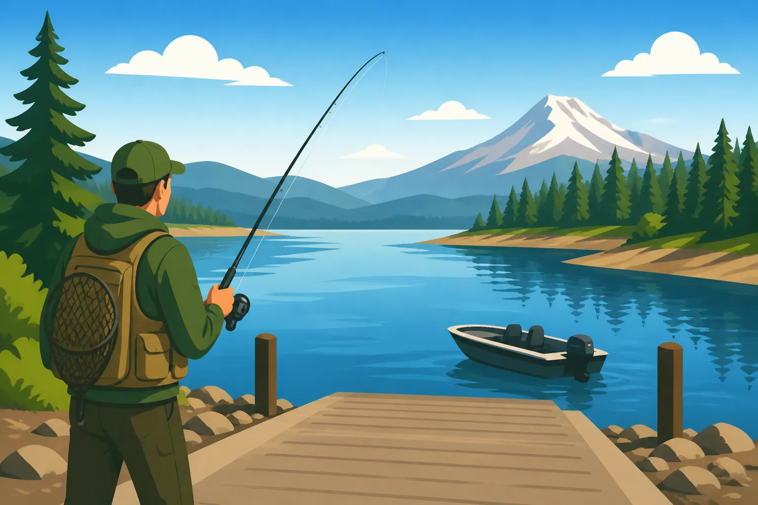
For most anglers heading to Wickiup with a trailerable boat, Gull Point is often the first stop that comes to mind. It's the most developed and reliably accessible area on the reservoir, making it a popular choice. Here, you'll usually find a paved boat ramp, which is a huge relief after navigating some of the gravel roads to get there. There are also restrooms, ample parking for trailers, and a designated campground, which is fantastic if you're planning an extended stay. The convenience of these facilities is a major draw, especially for families or those who prefer a more comfortable base camp. However, this popularity also means Gull Point can get quite crowded, particularly on summer weekends and during peak fishing seasons. If you're seeking solitude, this might not be your primary destination, but it's undoubtedly the most user-friendly. From Gull Point, you can easily access the vast open waters of the main reservoir, perfect for trolling for those trophy brown trout or schools of kokanee. Many anglers launching here also fish the nearby submerged structure, which can hold impressive fish.
A little further afield, but still a well-known access point, is Wickiup Butte. This spot tends to be a bit less developed than Gull Point, often featuring a gravel boat ramp rather than a paved one, and more primitive pit toilets. While it offers a slightly more rustic experience, it also often means fewer crowds, which can be a huge bonus for those looking for a bit more peace and quiet. The gravel ramp at Wickiup Butte can be more susceptible to low water levels, sometimes becoming unusable for larger boats as the reservoir draws down. However, for smaller powerboats, rafts, or those with more capable launch vehicles, it remains an excellent option. The fishing opportunities from Wickiup Butte are similar to Gull Point, providing access to open water and surrounding structures, but often with less competition. Both Gull Point and Wickiup Butte are managed by the Deschutes National Forest, so they often have well-marked signage, but always check their official websites for the latest conditions and any potential closures.
Less Developed Access: Deschutes National Forest and Dispersed Sites
Beyond the main hubs, Wickiup Reservoir truly opens up to those willing to explore. The Deschutes National Forest encompasses much of the shoreline, and a network of forest roads—like the famous Forest Road 40 which skirts much of the eastern side of the reservoir—provides numerous informal pull-offs and less formal access points. These are the spots where you trade amenities for solitude and the chance to discover your own hidden gem. However, they demand a different level of preparation and respect for the environment.
These less developed areas typically lack any facilities – no restrooms, no designated parking, and certainly no paved ramps. Access might involve driving down a dirt track, finding a suitable spot to pull over, and then hiking down to the water's edge. This is where a high-clearance vehicle becomes incredibly valuable, as these tracks can be rough, rocky, or deeply rutted. The rewards, however, can be immense: fewer people, pristine natural beauty, and often access to prime fishing waters that don't see as much pressure. Anglers seeking a truly wild experience, perhaps targeting trout in specific coves or inlets, often prefer these dispersed sites. It's a fantastic way to connect with nature, but it also comes with a greater responsibility to practice "Leave No Trace" principles. Pack out everything you pack in, and leave the area cleaner than you found it. These spots are also often the first to be impacted by extreme water level changes, requiring even more scouting and adaptability.
Kayak, Canoe, and Paddleboard Access
For those who prefer a paddle-powered approach, Wickiup Reservoir offers fantastic opportunities, and often, much simpler access. While powerboat anglers are constantly eyeing those boat ramp conditions, kayakers, canoeists, and paddleboarders have the distinct advantage of portability. You don't always need a formal ramp; a gentle slope, a sandy beach, or even a grassy bank can suffice as a launch point for these smaller craft. This means a wider array of shoreline becomes accessible for launching.
Many of the informal pull-offs along the forest roads that might be too primitive for a large trailer are perfectly suitable for unloading a kayak or canoe. This opens up countless quiet coves, marshy inlets, and secluded arms of the reservoir that larger boats might struggle to reach or simply overlook. Imagine silently gliding into a glassy bay at dawn, casting flies or small lures into water teeming with fish, far from the hum of outboard motors. It's a truly serene and effective way to fish Wickiup. Furthermore, these smaller watercraft allow anglers to explore the upper reaches of the Deschutes River and North Fork Deschutes River arms where they flow into the reservoir, areas that can be incredibly productive for trout and kokanee, especially during certain times of the year.
However, even with smaller craft, safety is paramount on a reservoir the size of Wickiup. It's a large body of water that can become very choppy quickly if the wind picks up, especially in the afternoon. Always wear a life jacket, check weather forecasts, and consider bringing a dry bag with essentials like a phone, first aid kit, and extra layers. Even though you might be launching from less formal points, the vastness of the reservoir demands respect, and preparedness is key to a successful and safe paddle fishing adventure.
Shoreline Fishing Opportunities and Considerations
Not everyone has a boat, or even wants one, when heading out to fish. For many, the simple pleasure of casting a line from the bank, wading into the shallows, or meticulously presenting a fly is the essence of angling. Wickiup Reservoir, despite its reputation as a boating lake, offers some truly fantastic opportunities for shoreline anglers, though it does require a bit of local knowledge and an understanding of its unique characteristics.
Identifying Productive Bank Fishing Spots
Finding a good bank fishing spot at Wickiup isn't just about finding a patch of accessible shore; it's about looking for structure, depth changes, and areas that provide cover or food for fish. One of the most productive areas for bank anglers is often near the main access points like Gull Point and Wickiup Butte. While these spots can be busy, the jetties, rocky points, and immediate drop-offs can hold a surprising number of fish, especially early in the morning or late in the evening. These areas are also easy to reach and provide a relatively clear casting lane.
Beyond the main campgrounds, look for sections of shoreline where the old river channel or creek beds might have once flowed into the main reservoir. These submerged features create contours and depth changes that attract trout and kokanee. Areas with standing timber, brush, or rocky outcrops, though often snag-prone, can be absolute magnets for fish seeking shelter and ambush points. Anglers often have success near the mouths of the Deschutes River and the North Fork Deschutes River arms where they enter the reservoir. These inlets provide fresh, cooler water and an influx of nutrients, drawing in fish.
When choosing your spot, consider how far you're willing to walk. Many of the less-trafficked forest roads allow you to pull off and find a secluded stretch of bank, but it might mean a longer hike through brush or soft mud, especially at lower water levels. For bait anglers, standard offerings like PowerBait, worms, or salmon eggs fished off the bottom with a sliding sinker rig are often very effective. Lure fishermen do well with small spinners, spoons, or even bobber-and-jig setups that imitate kokanee or other baitfish. Remember, patience is key, and don't be afraid to move if a spot isn't producing. For deeper insights into what works, you might consider checking out resources like "Oregon Bait and Lure Guide" to refine your approach.
Wading and Fly Fishing Access
For those who enjoy the intimate connection of wading into the water, Wickiup presents a unique and sometimes challenging experience, but one that can be incredibly rewarding for fly fishing enthusiasts. Unlike a clear, rocky stream, much of Wickiup's bottom is silty and soft, especially in shallower areas. Wading can be tricky, often involving sinking into soft mud, so careful footing and a good wading staff are essential. However, finding those firmer, gravelly stretches or areas around rock outcrops can provide excellent opportunities to get closer to the fish.
The most promising areas for wading and fly fishing are often found near the inlets of the Deschutes River and the North Fork Deschutes River. Here, the current from the rivers deposits harder substrate, and the moving water creates more defined seams and holding lies for trout. These areas are fantastic for targeting larger brown and rainbow trout, particularly during spring and fall. Fly anglers often have success stripping streamers that imitate baitfish or leeches, or fishing subsurface with nymphs like Chironomids or Callibaetis patterns when hatches are occurring. Dry fly fishing can be productive during evening hatches, especially in calmer coves. For more specific techniques, a visit to a page like "How to Fly Fish in Oregon" could offer valuable insights.
Wading into Wickiup allows for a stealthy approach, letting you access pockets of water that might be out of reach from the bank or too shallow for boats. It's a wonderful way to experience the reservoir's wild side, but it demands respect for the environment and an understanding of your physical limits. Always be aware of changing water depths and soft bottom conditions. The variable water levels also play a huge role here; what was wadable one week might be an impassable mud flat or suddenly too deep the next. Always check conditions and plan your wading routes carefully to ensure safety and success.
Planning Your Trip to Wickiup: Practical Advice
A successful fishing trip to Wickiup Reservoir isn't just about knowing where to go; it's about being prepared for the journey, the conditions, and the unique regulations of this special place. Being proactive with your planning can make all the difference between a memorable day of fishing and a frustrating experience.
Essential Gear for Wickiup Access
When heading to Wickiup Reservoir, your tackle box is just the beginning. The remote nature and variable conditions of the Central Oregon high desert demand a comprehensive approach to packing. First and foremost, consider your vehicle. As mentioned, a 4×4 or at least an AWD vehicle with good ground clearance is highly recommended, especially if you plan to explore beyond the main paved access points. Don't forget a full-sized spare tire, a jack, and tools for changing a flat. A shovel and some recovery boards could save you a lot of grief if you encounter soft mud or sand. Navigation is another critical piece of the puzzle; while cell service is spotty, offline maps on your phone (like Google Maps or Gaia GPS), combined with a physical map of the Deschutes National Forest, are invaluable. Knowing where you are and how to get back is non-negotiable in remote areas.
Beyond vehicle preparedness, personal safety gear is paramount. Pack a comprehensive first-aid kit that's suitable for remote wilderness, along with ample water and extra food, even for a day trip. The weather in Central Oregon can change rapidly, so dressing in layers is crucial. Bring waterproof outer shells, even on sunny days, as sudden showers or wind can sweep across the reservoir. Sun protection – hats, sunglasses, and sunscreen – is also a must, as the high desert sun can be intense. For anglers, specific gear will depend on your target species, but having a variety of lures and baits is wise, as fish preferences can change throughout the day. A long-handled net is excellent for landing larger trout or kokanee, and a pair of sturdy waders can be a game-changer for accessing shoreline spots, though be mindful of the soft bottom.
Staying Informed: Regulations and Conditions
Ignorance of the rules is never an excuse, especially when it comes to fishing regulations. Before you even think about driving towards Wickiup, the very first thing you need to do is consult the latest Oregon Fishing Regulations Explained published by the Oregon Department of Fish and Wildlife (ODFW). These regulations are updated annually and often include specific rules for individual water bodies like Wickiup Reservoir. Pay close attention to bag limits, size restrictions, open seasons for different species (like trout, kokanee, or bull trout if present, though bull trout are generally catch-and-release and require a special permit), and any gear restrictions. You also need a valid Oregon fishing license, and potentially a combined angling tag, so make sure you review the "Oregon Fishing License Guide" beforehand to ensure you're fully compliant. Violations can lead to hefty fines and confiscation of gear, truly ruining a day that was meant for relaxation.
Beyond official regulations, staying informed about current conditions is just as important for a successful trip to Wickiup. As we've discussed, water levels are incredibly dynamic here. Websites from the Bureau of Reclamation or USGS often provide real-time or near real-time water level data for Wickiup Reservoir, which can tell you if boat ramps are usable or if favorite shoreline spots are underwater or dried up. Road conditions, especially on the gravel forest roads, can also change due to weather or maintenance. Checking the Deschutes National Forest website or calling the local ranger district can provide critical updates on road closures or hazards. Lastly, local weather forecasts are essential, particularly for wind warnings. A calm morning on Wickiup can turn into a white-capping, dangerous ordeal for small boats and paddlecraft if a strong afternoon wind rolls in, so always prioritize safety over getting that "one last cast."
Finding Local Expertise and Guided Trips
Sometimes, the best access isn't just about a road or a ramp; it's about knowledge. For anglers who are new to Wickiup Reservoir, or even seasoned veterans looking to refine their techniques or explore new areas, tapping into local expertise can dramatically enhance the fishing experience. The first place to start is often a local tackle shop. Shops like The Hook Fly Shop in Sunriver or even the larger Cabela's in Bend are treasure troves of information. The staff usually fishes these waters regularly and can provide invaluable, up-to-the-minute reports on what's biting, what baits or flies are working, current water levels, and, crucially, specific access conditions for different parts of the reservoir. Don't be shy; these folks love to talk fishing and want to see you succeed.
For an even more immersive and effective experience, especially if you're targeting specific species like the trophy brown trout Wickiup is famous for, consider hiring a local fishing guide. These professionals spend countless hours on the water, know the secret spots, understand the nuances of the changing water levels, and can teach you specific techniques tailored to Wickiup. While there's a cost involved, the value in terms of knowledge, safety, and increased chances of success is often well worth it, particularly for a special trip. Many reputable guides who specialize in Central Oregon waters list their services on platforms like FishingBooker, making it easy to browse options, read reviews, and book a trip. When looking at options on FishingBooker, you can filter for guides who specialize in reservoir fishing or targeting specific species like kokanee or trout. A good guide will not only put you on fish but also teach you about the ecosystem, the local regulations, and how to read the water effectively. Booking through a service like FishingBooker often provides peace of mind, as they typically feature licensed and experienced professionals. Before booking, check their availability on FishingBooker for your preferred dates and discuss your fishing goals to ensure a good match. They can help navigate everything from the "Oregon Fishing Seasons Explained" to the specific nuances of fishing for "Oregon Trout Species Guide" in Wickiup.
| Access Point | Facilities | Best For | Water Level Sensitivity | Notes |
|---|---|---|---|---|
| Gull Point | Paved Boat Ramp, Restrooms, Campground, Picnic Area | Powerboats, Family Fishing, General Angling | Moderate | Most popular, can be crowded. Good for general trolling and bank fishing. Amenities make it family-friendly. |
| Wickiup Butte | Gravel Boat Ramp, Pit Toilets, Primitive Camping | Smaller Powerboats, Kayaks, RV Camping | High | Less crowded than Gull Point. Ramp can be unusable at low water. Offers a more rustic experience. |
| Forest Road 40 | Informal Pull-offs, No Facilities | Kayaks, Canoes, Bank Anglers, Waders | Very High | Provides numerous informal spots. Requires careful navigation on rough roads. Ideal for exploring quieter areas. |
| North Fork Arm | Informal Pull-offs, No Facilities | Kayaks, Fly Fishing, Secluded Bank Anglers | Very High | Access to the North Fork Deschutes inlet. Excellent for trout and kokanee, but often requires wading or hiking. |
Disclaimer
Please remember that fishing conditions, regulations, and access points can change rapidly due to weather, environmental factors, or updates from the Oregon Department of Fish and Wildlife and the Deschutes National Forest. Always check the most current regulations and conditions before heading out on any fishing trip. Safety is paramount, especially in remote areas like Wickiup Reservoir.